Below is a collection of weather models producing snow output. The model uses the forecast QPF (quantum precipitation forecast) and then applies a liquid to snow ration via the kuchera method. The lower the temperature when snow is expected, the higher the snow ratio and higher the snow forecast. If the temperature is warmer the snow will be heavy/wet and net a lower total.
GFS Model: (All times in central time)
(00z) ready at 11:15pm:
1 Day Total
2 Day Total
3 Day Total
4 Day Total
5 Day Total
5 Day Total Regional Maps
(06z) ready at 6:15am:
1 Day Total
2 Day Total
3 Day Total
4 Day Total
5 Day Total
5 Day Total Regional Maps
(12z) ready at 12:15pm:
(18z) ready at 6:15pm:
NAM Model:
(00z/12z) ready at 9:30am/pm
1 Day Total
2 Day Total
3 Day Total
3.5 Day Total
3.5 Day Total Regional Maps
(06z/18z) ready at 4:30am/pm:
1 Day Total
2 Day Total
3 Day Total
3.5 Day Total
3.5 Day Total Regional Coverage
Canadian Model (GEM) 12z
24 Hour Total
48 Hour Total
72 Hour Total
96 Hour Total
120 Hour Total
144 Hour Total
Canadian Model (GEM) 00z
24 Hour Total
48 Hour Total
72 Hour Total
96 Hour Total
120 Hour Total
144 Hour Total
Official NWS Gridded Snow Forecasts
Usually out to 60 or 54 hours.
Complete United States
Northeast
Mid-Atlantic
Ohio Valley
West Coast
Mid-Mississippi Valley
Minnesota
Wisconsin
Illinois
Iowa
Indiana
Lower Michigan
Colorado
South Dakota
North Dakota
Nebraska
Ohio
Chicago
Minneapolis
Milwaukee
Green Bay
Marquette
Detroit
Grand Rapids
Des Moines
St. Louis
La Crosse
Omaha
Denver
Kansas City
Springfield, MO
(Send a message if you want more regions added! On either FB or Twitter, info on right)
UW-NMS Model
00z
24 Hour Total
48 Hour Total
72 Hour Total
96 Hour Total
06z
24 Hour Total
48 Hour Total
72 Hour Total
96 Hour Total
12z
24 Hour Total
48 Hour Total
72 Hour Total
96 Hour Total
18z
24 Hour Total
48 Hour Total
72 Hour Total
96 Hour Total
24 Hour Total
48 Hour Total
72 Hour Total
96 Hour Total
120 Hour Total
144 Hour Total
Official NWS Gridded Snow Forecasts
Usually out to 60 or 54 hours.
Complete United States
Northeast
Mid-Atlantic
Ohio Valley
West Coast
Mid-Mississippi Valley
Minnesota
Wisconsin
Illinois
Iowa
Indiana
Lower Michigan
Colorado
South Dakota
North Dakota
Nebraska
Ohio
Chicago
Minneapolis
Milwaukee
Green Bay
Marquette
Detroit
Grand Rapids
Des Moines
St. Louis
La Crosse
Omaha
Denver
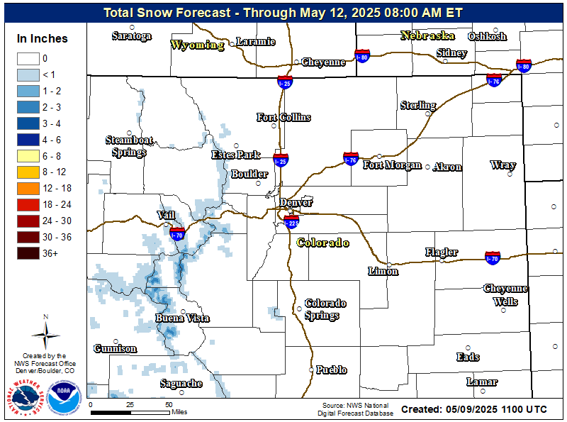
Kansas City
Springfield, MO
(Send a message if you want more regions added! On either FB or Twitter, info on right)
UW-NMS Model
00z
24 Hour Total
48 Hour Total
72 Hour Total
96 Hour Total
06z
24 Hour Total
48 Hour Total
72 Hour Total
96 Hour Total
12z
24 Hour Total
48 Hour Total
72 Hour Total
96 Hour Total
18z
24 Hour Total
48 Hour Total
72 Hour Total
96 Hour Total